Scenario
GeoXplorers is a geoscience consultancy firm that provides a variety of exploration, mapping and modelling services to help clients identify potential sites for mineral extraction and mining. The firm also specialises in groundwater exploitation and treatment, and facilitating environmental protection and remediation. Tanja is the Exploration Manager for GeoXplorers taking care of the team involved in identifying potential localities for mining and managing the environmental impact of mineral and groundwater exploitation for clients through mapping, sample collection, surveying, and modelling. As project manager she is responsible for managing the team and communicating with clients to disseminate findings and project status. As most of the team are field-based, she is largely managing them remotely, with only David located in the same office.
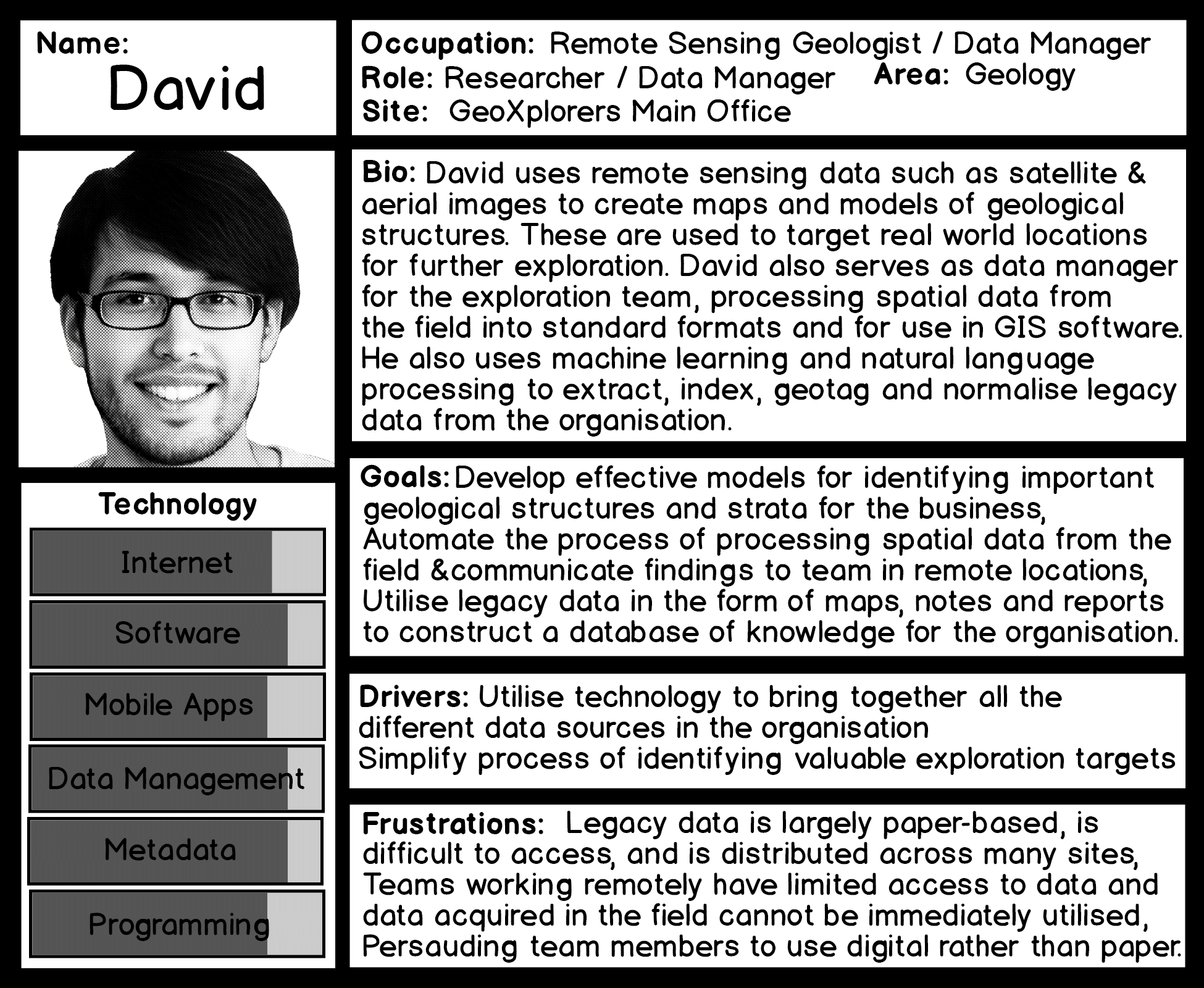
David is a remote sensing geologist analysing and modelling data from satellite and aerial photographs to create maps of large-scale geographical, geological and structural features that are stored in a Geographical Information System (GIS). David also doubles as the team’s data manager taking care of remote data collection and incorporating new mapping and survey taken in the field with the existing data on their GIS and other systems. David utilises machine learning and natural language processing to extract useful data from the company’s legacy records. He also ensures that the team have all the appropriate maps and other information they need on their field computers when they undertake exploration and survey work.
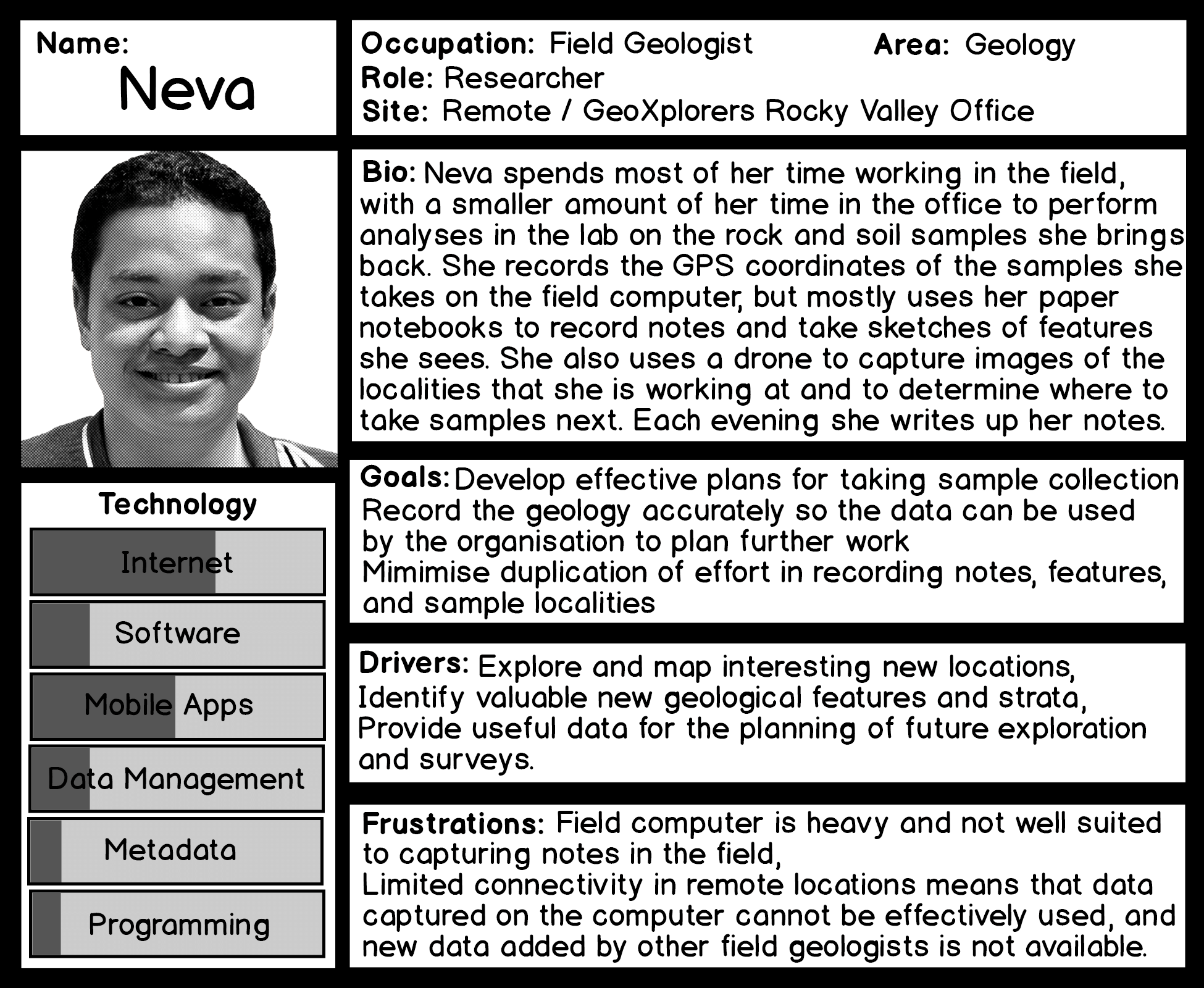
Neva is a field geologist who works from the Rocky Valley field office. When she is sent on exploration, she is often in a remote location and her camp often has a very limited connection to phone or data signals. As a traditionally trained geologist she works on paper to draw maps, make sketches, and take notes to determine the geology of the area she is exploring. She does make use of more modern technology in her work, for example capturing accurate GPS coordinates of the rock, soil and sediment samples that she takes, taking photographs alongside her sketches, and also uses a drone to capture more large scale aerial images for David and to identify interesting features for further investigation. When she is in the office she analyses her samples from the field and also writes up her reports for Tanja.
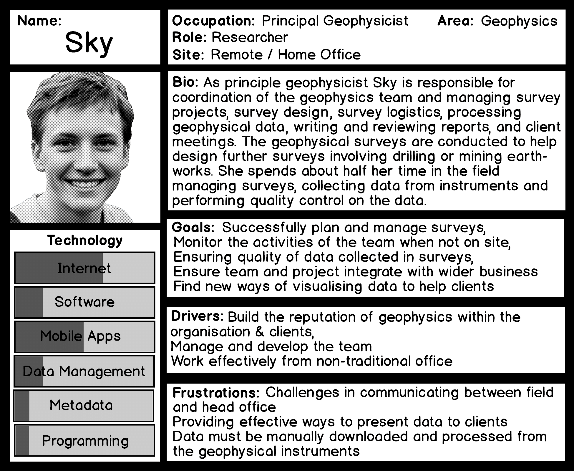
Sky works from her home office managing a team of geophysicists, but also spends half her time in the field directly supervising them. The geophysics team are sent into the field to conduct surveys to help GeoXplorers and their clients to identify the sub-surface geology and features for planning mining operations or drilling, what the value of minerals on a piece of land may be worth, and to install probes for on-going monitoring of a particular area. Sky manages survey logistics, but also collects and monitors data for quality control, analyses the data, writes reports and meets with clients on site to discuss the survey and findings. Sky regularly meets remotely with Tanja and other project managers to discuss new and ongoing projects.
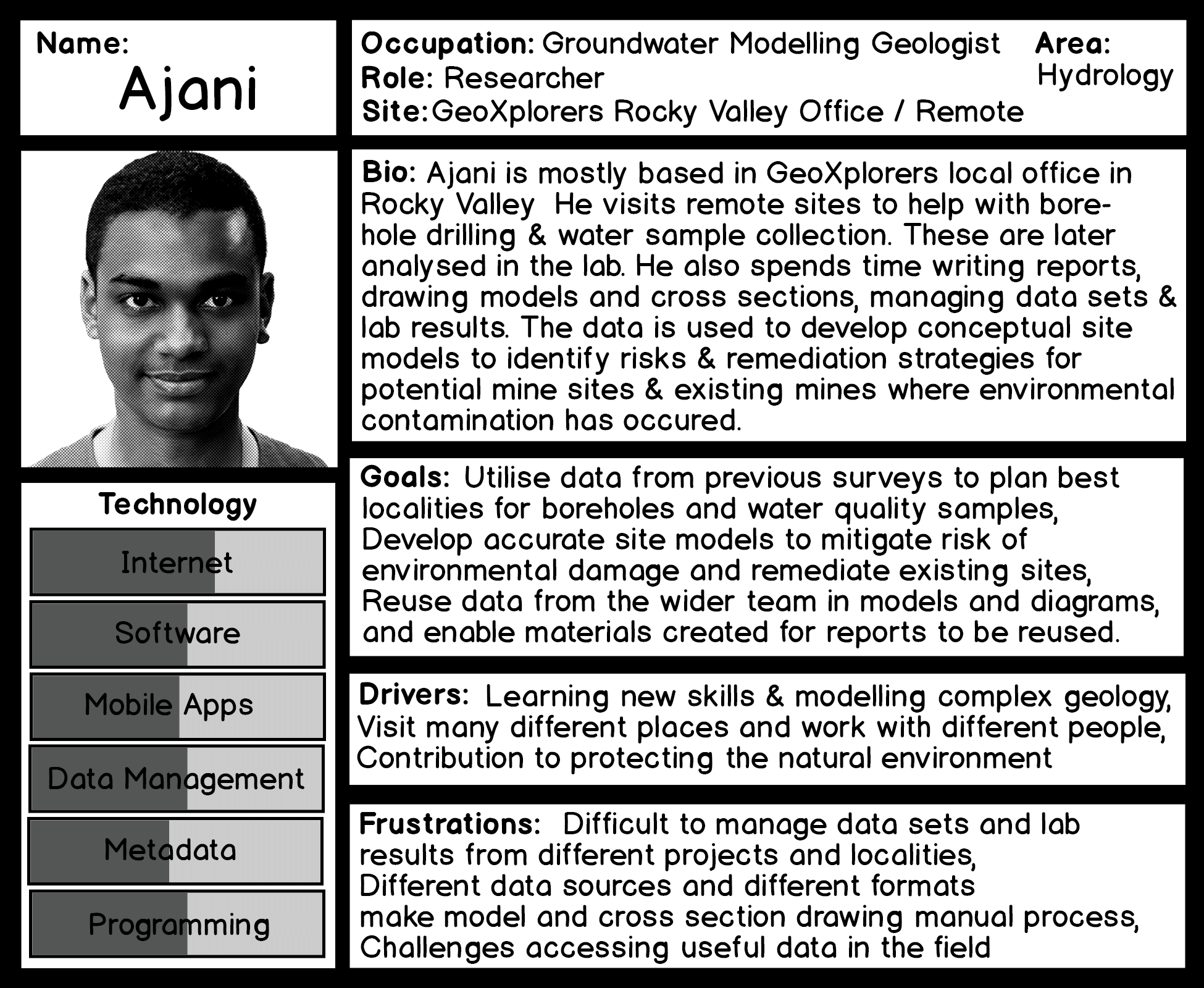
Ajani is a groundwater modelling geologist based out of the Rocky Valley field office. Ajani spends some of his time out in the field helping the team with drilling boreholes and taking water samples. In the office, Ajani analyses his samples in the lab, but spends most of his time analysing data and producing diagrams and geological cross sections to develop conceptual site models to help identify risks to the groundwater supply and development of remediation strategies. These are written up into reports for Tanja and the client.
Tanja is a project manager. Neva, David, Sky and Ajani are researchers, but Sky also does some project management and David doubles as data management for the team.
Personas

Personas for the Scenario Geosciences
Data Paths

G1-DP1: Client mining project lifecycle
Storyboards

G1-SB1: A new client is looking for the best place to open a new mine

G1-SB2: Neva is exploring a candidate locality for a new mine